
Our dear friend Margaret has a unique skill. Whenever she comes up, we see lots of wildlife—without fail. This time was no different, just, um...better.

Adventures from Arizona to Alberta
Viewing entries tagged
Banff National Park
Our dear friend Margaret has a unique skill. Whenever she comes up, we see lots of wildlife—without fail. This time was no different, just, um...better.
In the past, a hike to Lake Annette in Banff National Park was as simple as turning up Moraine Lake Road and following the signs to the trailhead. Then access, in our minds, became, well, challenging—or so we thought. Thankfully, we were mistaken.

The trail at sunrise.
The freedom to drive up to Lake Louise or Moraine Lake on a whim is no easy feat. Since most areas can no longer handle the masses that frequent every summer, shuttles and reservations are the new normal. However, Lake Annette Trail is outside the Moraine visitors’ lot, so the dilemma was, how do we get in?
With that in mind, Dave and I made a plan. Our strategy was to arrive at the turnoff before sunrise and, with any luck, get to the trail before the roadblock. The road was blocked; however, gaining entrance was as simple as asking—“can we get in to hike Lake Annette?” Yep, it was that easy.
We pulled into the small dark parking area and waited for dawn. Despite being bundled up, the early morning chill quickened our pace.

A colorful preview of what was to follow.

First crossing.

The hike to Lake Annette logs 7.1 miles (11.3 km) roundtrip, with a moderate elevation (1,300 ft, 400 m).

Sunrise magic.

The term scenic does not do this hike justice.

The second crossing.

Dave nearing the lake.
With lunch packed, we arrived at the lake just in time for breakfast. Dave and I decided the sandwiches could wait. Being first at the lake felt pretty darn special. We passed quite a few hikers on the way down, happily hiking without restrictions.

Lake Annette.
For spur of the moment hikers, this is a perfect way to explore the beauty of the Moraine Lake/Paradise Valley area—no shuttle required.
Like clockwork, Dave and I go hiking, and two days later, I’m angling about the next hike. This past week we were looking for something less arduous—one without scrambling or scree—a forest walk to Taylor Lake.
In the past, Dave and I have avoided Banff's Lake Minnewanka. Memories of crowded parking lots, shuttles, and tour buses have always discouraged us from exploring the area. That is until we decided to hike the Minnewanka Lakeside Trail to Alymer Pass Junction.
Picture this: a bike ride on one of the busiest and most scenic highways in Banff National Park. Pretty sweet, right? Now take motor vehicles out of the equation. For Dave and I, this was an opportunity too good miss.
Still hot here. Yep. A broken record of record-breaking heat. However, the desert shadows are getting longer and the days shorter, so there’s hope.
Labor Day is upon us along with, you guessed it, record heat. However, in Arizona, we’ve turned the corner—it’s September, and October is just within sight. Hallelujah.
sually, when the word sightseeing is used, I’ll turn and run the other way. I know, it’s my problem, but I can’t help thinking of everything associated with it—as in tourists, crowds, lines, etc. So naturally, Dave and I were skeptical of the Banff Sunshine Sightseeing Gondola from the get-go.
We often share hiking stories with our neighbors, Kirstie, and Kevin. Really, the best way to know what you are getting into is to talk to someone who has done it. And recommends it. This was the case with Healy Pass in Banff National Park.
Our reason behind hiking Taylor Lake was simple. There was a connection. You see, Dave’s Mom’s maiden name was Taylor. The name alone rekindled wonderful memories for him—even before our hike began.
Smoke and haze. B.C. is on fire again. After a week of poor air and visibility, we finally got a bit of a break. The wind turned to the east and started blowing the smoke back from where it came. We also got a little rain. Yay! The end result was a couple of days with fairly clear, clean air. Perfect for taking a bike ride on the Cascade Valley Trail in Banff.

Cascade Valley Trailhead

One of several ponds along our path to the river.
The rain had softened the trail a bit. It was kind of like biking through a sandy, rocky wash. Every pedal stroke seemed to take more and more effort. Prior to the bridge the trail wasn't bad—a wide, moderate climb.


The new bridge over the Cascade River, replacing the one destroyed in the 2013 flood.

Cascade River

But once across the Cascade river, the trail turned rocky. Whine. I fondly remembered the last time we were slogging up the rocks when we turned back and saw a mother grizzly and her cub cross the road. That had been my personal turnaround point. Oh, and then the time Dave biked to the top of the a hill and after catching his breath, looked up and surprised a giant black bear. No such encounters this time.

Rest stop on the trail.
Heading back, we enjoyed a quick lunch on the bridge, then continued with a fast, bumpy return to the Jeep. A nice reward for the effort.
Looking back, all I can say is, “Thank goodness for Motrin.”
I saw it on the CTV news. Actually, it was one of those photo posts from a viewer—you know, the kind they show on the nightly weather forecasts. I hurriedly wrote down Chephren Lake Trail, Banff.
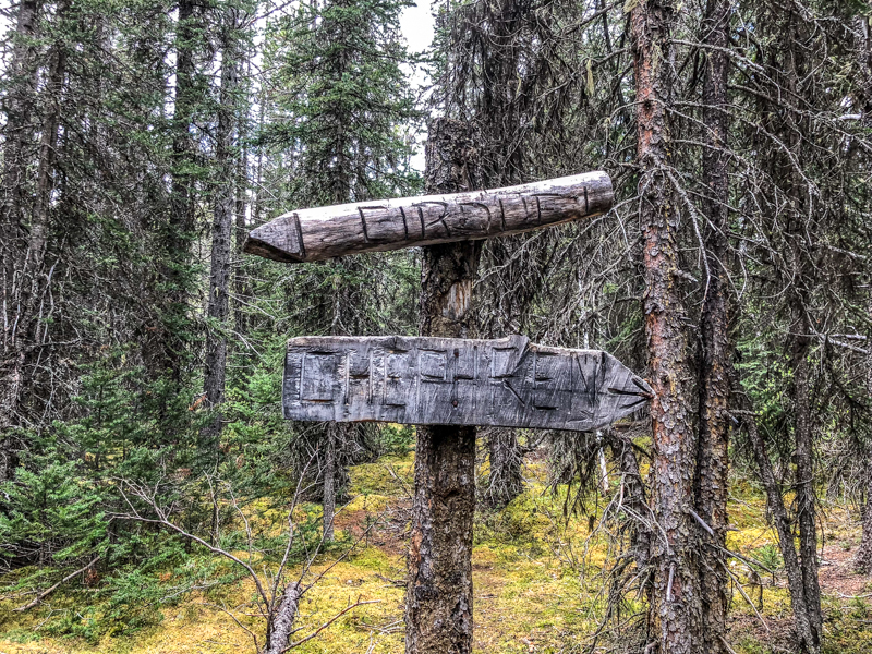
There are so many beautiful hikes that exist much closer to home. However, the image of the lake encouraged us to branch out a bit. The Chephren Lake Trail is a 2-hour drive from Canmore, and is located off the Icefields Parkway. Normally, a long way to travel for a relatively short hike.

A view from the trailhead.

Trailside meadow.
We pulled into the Waterfowl Lakes Campground and headed to the trailhead – a bridge crossing over the Mistaya River. From there we ascended through the muddy, twisted roots of an old growth spruce forest. Then, just as we started wondering about the worth of this little excursion, we rounded a corner. The images below speak for themselves.


This was an extraordinary summer. Fires raged and ashes fell. Blue skies gave way to an orange glow. Lack of rain encouraged the flames wrath. There was still beauty amongst the ashes.


